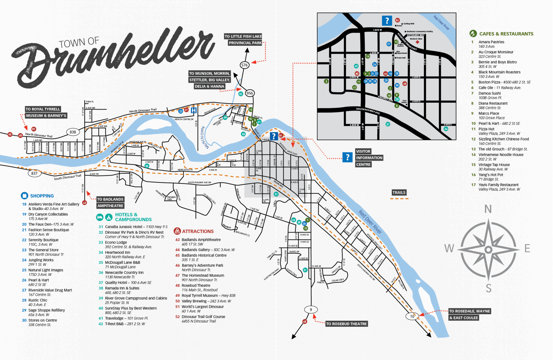
- Traveling by Car
Drumheller is located on HWY 9 along the Red Deer River Valley in the heart of the Canadian Badlands. Coordinates 51° 27’ 49” N 112° 43’ 10” W.
Be sure to check driving conditions, which are updated hourly and available from Alberta Motor Association – Road Reports.
Distances and times by car:
- Calgary: 110 km (68 mi) 1 hr 30 min
- Edmonton: 280 km (174 mi) 3 hrs
- Drumheller: 6 km (4 mi) 7 min
- Red Deer: 169 km (105 mi) 2 hrs
- Banff: 264 km (163 mi) 3 hrs
- Brooks: 138 km (85 mi) 1 hr 30 min
- Lethbridge: 302 km (188 mi) 3 hrs 15 min
- Medicine Hat: 251 km (156 mi) 2 hrs 30 min
- Traveling by Air
Drumheller is a 90 minute drive NE of Calgary, AB and the Calgary International Airport (YYC). The Calgary International Airport services all major airlines and airports around the world.
Airport travel providers:
- Traveling by Bus
Getting to Drumheller without a car is easier than ever. During summer 2026, you can travel between Calgary and Drumheller aboard FlixBus, with convenient stops in downtown Calgary, at Whitehorn LRT Station, and at Calgary International Airport (YYC). In Drumheller, buses stop in downtown Drumheller and at the Royal Tyrrell Museum. Visit FlixBus online for schedules, fares, and ticket bookings.
Once you’re here, explore more of the valley with ValleyConnect. Operating from June 26 to August 29, ValleyConnect is a free hop-on, hop-off shuttle service connecting many of Drumheller’s most popular attractions, museums, campgrounds, accommodations, and downtown destinations. Stop locations available on Google Maps.